January 09, 2023
PPM - how to calculate the best path for field agents.
An essentiel module of the INTREPID project : the Path Planning Module
What is PPM?
PPM, or Path Planning Module, is the module which takes care of calculating and creating the path on the INMOS between two designated points in the area, for a mobile object. TUM is in charge of this module.
A path can be built for several goals:
- Plan the shortest path
- Optimize the path to take the safest path.
- Optimize the path so the agent would be able to investigate the whole area in the quickest time.
- ...
For now, TUM is focusing on building the shortest and safest path, as it’s the primary goal in disaster situation, for first responders, drones (UAV), and robots (UGV).
In order to plan a path, an environment is needed. For the INTREPID project, we are using indoor and outdoor environments. The digital environment representation can be created from a given building model, in our case, we are using the BIM (Building Information Modeling). The BIM is a detailed 3D model of a building. This environment format is graph based, so we are trying to find out location where the notes are set, then we use an algorithm to create a path in this graph.
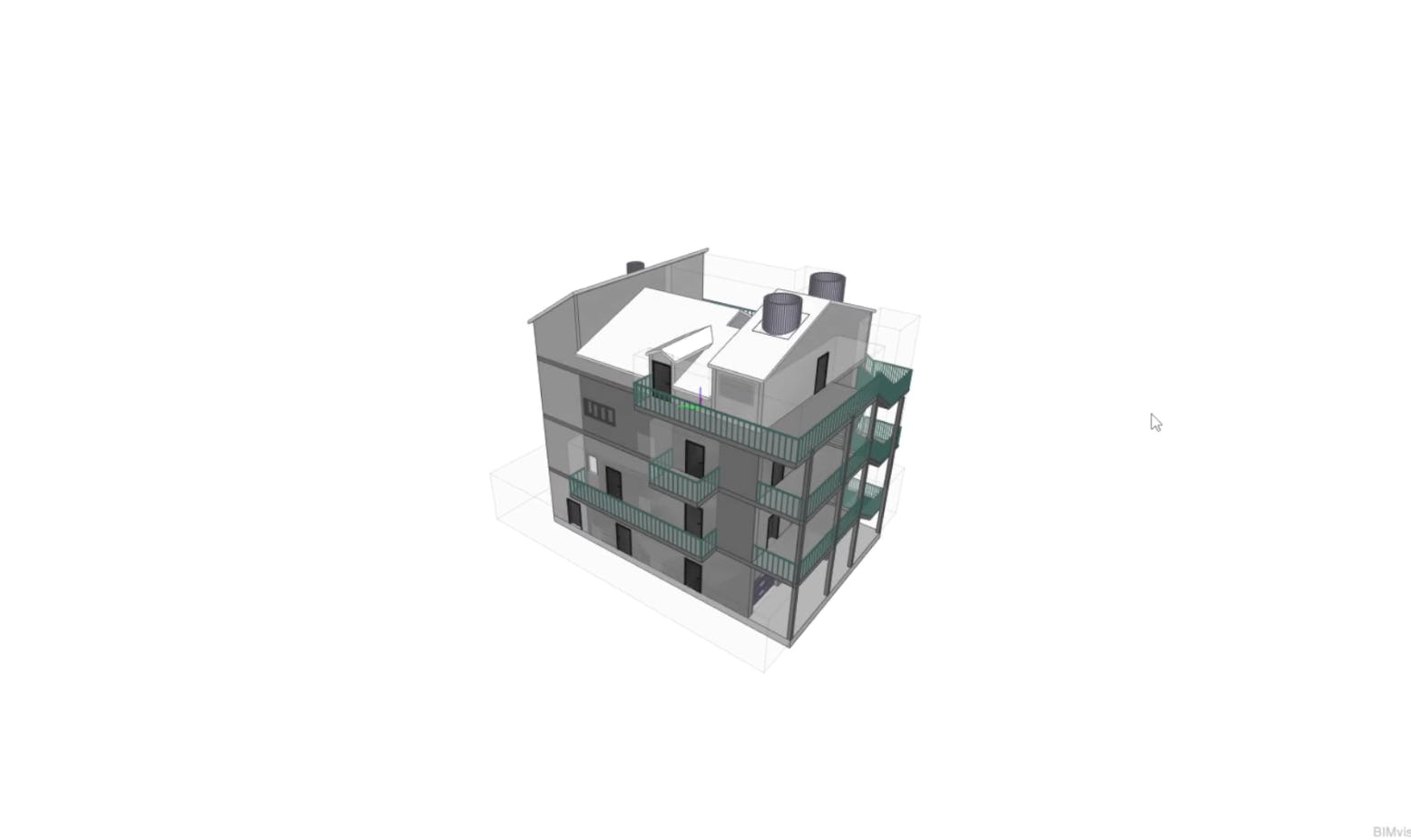
Pilot 2 Building Information Modeling screenshot
PPM Functionalities
As already mentioned, the BIM is the main source in which the path will be calculated. But added to the environment the PPM needs to include specific information for the different mobile objects. For instance, robots can’t access windows (at least for now), when drones can, and first responders might use it. So, this needs to be taken into account to create the right path for the right agent. This information is defined in advance, thanks to collaborative work between technical partners and first responders.
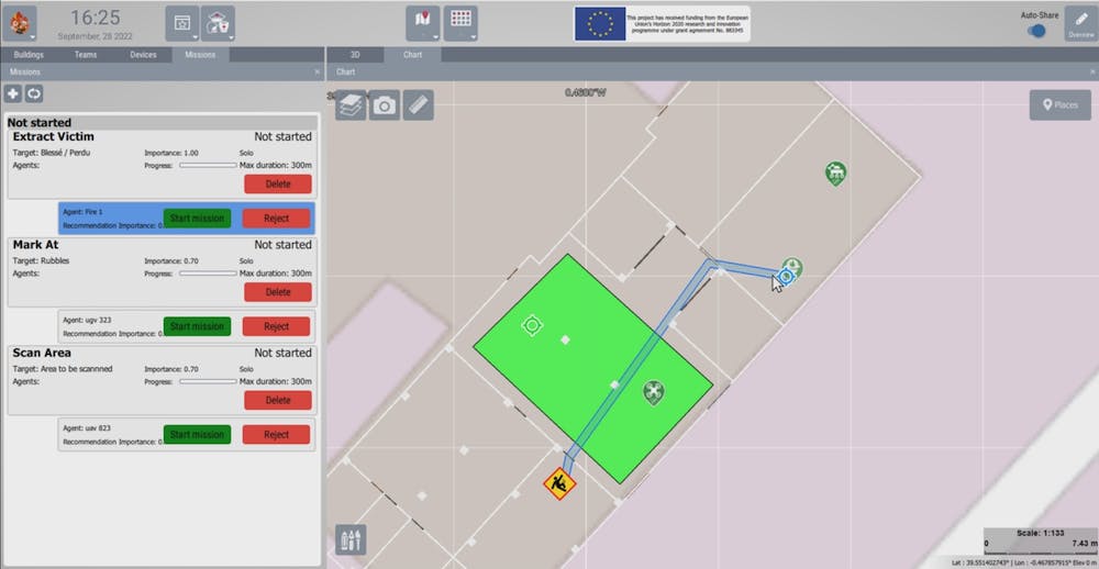
Screenshot of the path planning recommandation on INMOS.
Field information
But in order to be the most accurate, and safe possible it also relies on updated information, as in disaster scenario there could be unavailable areas, or destroyed areas on the building.
To collect all these “fields” information, the PPM can count on the others module, such as the IAM, the EAM and of course the EMM. They are gathering information from the field, from how the field looks. Therefore, the PPM gathered all these information, and calculate the best path depending on the demand. The PPM proposes multiple paths to the IAM and the IAM chooses the right one for its recommendation.
Next steps
It's the integration of a large amount of semantic information which can be processed by the Path Planning Module in order to calculate the shortest, safest, accessible paths through the building, as well as path planning around dynamic obstacles which occur during the disaster scenario.
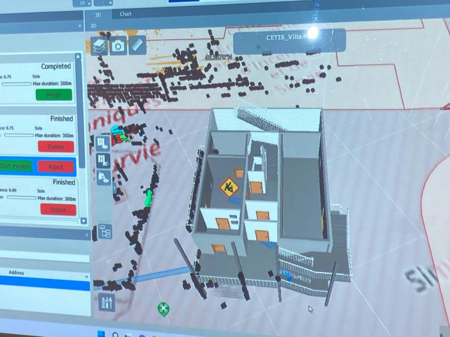
Screenshot of the 3D path.
Want access to exclusive INTREPID content? 💌 Subscribe to our newsletter! 💌
Let's keep in touch


